Patagonia, Chile/Argentina: The W Trek
Patagonia, a land of towering granite peaks, turquoise lakes, and ancient forests, offers some of the world’s most breathtaking hiking. The W Trek in Torres del Paine National Park is arguably its most iconic. Spanning approximately 75 kilometers (47 miles), this trek takes 4-5 days to complete, connecting the park’s most famous landmarks: the base of the Torres del Paine (granite towers), the French Valley, and Grey Glacier.
The trail’s ‘W’ shape allows hikers to experience a diverse range of landscapes. The initial leg often involves trekking alongside the vibrant blue waters of Lake Pehoé, leading to the Ascencio Valley and the challenging ascent to the Mirador Las Torres. This viewpoint rewards hikers with unparalleled views of the three iconic granite towers piercing the sky, often shrouded in swirling clouds. Early morning is crucial for clear views, and stamina is required for the steep climb.
Next, the trek usually continues westwards towards the French Valley. This involves hiking through native beech forests and across suspension bridges. The French Valley is an amphitheater of granite walls, glaciers, and waterfalls. The trail winds deeper into the valley, offering stunning perspectives on the hanging glacier of the French Glacier and the dramatic peaks of Cerro Paine Grande and Los Cuernos. The sound of calving ice from the glacier adds to the immersive experience.
The final leg of the W Trek heads towards Grey Glacier. This section involves navigating undulating terrain and traversing rocky sections. Reaching the shores of Grey Lake, hikers can witness the impressive blue ice of Grey Glacier calving into the lake. Optional ice hiking tours on the glacier itself are available for a more intimate encounter. The trail often concludes with a boat trip across Grey Lake, providing a final panoramic view of the glacier and surrounding mountains.
The W Trek requires moderate fitness levels and careful planning. Accommodation options range from campsites (requiring advance booking, particularly during peak season) to refugios (mountain huts offering beds and meals). Weather in Patagonia is notoriously unpredictable, so packing layers of clothing and waterproof gear is essential. Permits are required for entry to the National Park and for camping. The best time to hike the W Trek is during the Patagonian summer (November to March).
Inca Trail, Peru: Journey to Machu Picchu
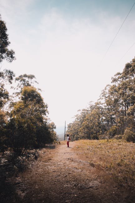
The Inca Trail is a legendary hiking route that culminates in the iconic lost city of Machu Picchu. This 43-kilometer (26-mile) trek traverses through diverse ecosystems, from cloud forests to high alpine terrain, following the ancient path used by the Incas centuries ago.
The classic 4-day Inca Trail starts at Km 82 (Piscacucho) and requires permits, which are highly regulated and must be booked months in advance, especially for travel during the high season (May to September). All trekkers must be accompanied by a licensed tour operator, employing porters to carry equipment and food, further contributing to the local economy.
The first day is relatively gentle, ascending gradually through lush valleys. The second day is the most challenging, involving a steep climb to Dead Woman’s Pass, the highest point of the trail at 4,215 meters (13,829 feet). Altitude sickness can be a significant concern, so acclimatization beforehand is crucial.
The third day offers stunning views of the surrounding mountains and valleys, as the trail descends into cloud forests. This section includes visits to several Inca ruins, providing insights into their advanced engineering and architectural skills. The final day involves an early morning start to reach the Sun Gate (Inti Punku) for sunrise, offering the first breathtaking panoramic view of Machu Picchu. Descending into the city itself, hikers can explore the intricate stonework, temples, and plazas of this ancient wonder.
The Inca Trail is a moderate to strenuous trek, requiring good physical fitness and acclimatization to altitude. Porters carry most of the equipment, but hikers should still be prepared to carry a daypack with essentials like water, snacks, and rain gear. The best time to hike the Inca Trail is during the dry season (May to September). Be aware that the trail is closed in February for maintenance.
Mount Kilimanjaro, Tanzania: The Roof of Africa
Mount Kilimanjaro, the highest free-standing mountain in the world, presents a challenging yet rewarding ascent. Reaching the summit, Uhuru Peak at 5,895 meters (19,341 feet), is a significant accomplishment that offers breathtaking views across the African plains.
Several routes lead to the summit, each with varying degrees of difficulty, acclimatization profiles, and scenic beauty. The Marangu Route, often called the “Coca-Cola Route,” is the most popular and arguably the easiest, offering dormitory-style huts along the way. However, its shorter acclimatization profile can lead to higher rates of altitude sickness.
The Machame Route, also known as the “Whiskey Route,” is more scenic and offers better acclimatization, making it a popular choice despite being slightly more challenging. This route involves camping in tents. The Lemosho Route is considered one of the most scenic routes, with stunning views and a gradual ascent, offering excellent acclimatization opportunities.
The Rongai Route approaches Kilimanjaro from the north, offering a more remote and less crowded experience. It is also known for its gentler slopes. Regardless of the chosen route, all treks are accompanied by guides and porters, who play a crucial role in ensuring a safe and successful ascent.
Acclimatization to altitude is paramount when climbing Kilimanjaro. Gradual ascent, drinking plenty of water, and avoiding strenuous activity at higher altitudes are crucial. Symptoms of altitude sickness should be closely monitored, and descent is necessary if symptoms worsen.
The best time to climb Kilimanjaro is during the dry seasons (January to March and June to October). Kilimanjaro National Park fees are substantial and form a significant portion of the overall cost. A climb typically takes 5 to 9 days, depending on the route chosen.
Annapurna Circuit, Nepal: Himalayan Majesty
The Annapurna Circuit is a classic trekking route in the Himalayas of Nepal, offering a diverse range of landscapes, cultures, and experiences. The trek circumnavigates the Annapurna massif, passing through rhododendron forests, terraced rice paddies, alpine meadows, and crossing the Thorong La pass at 5,416 meters (17,769 feet), one of the highest trekking passes in the world.
The trek traditionally starts in Besisahar and ends in Pokhara, but due to road construction, many trekkers now start further up the trail to shorten the trek. The full circuit typically takes 14-21 days, depending on the chosen itinerary and pace.
The trek passes through several distinct cultural zones, offering insights into the lifestyles and traditions of the Gurung and Magar people. Tea houses (guesthouses) provide accommodation and meals along the route, offering a comfortable trekking experience.
The ascent to Thorong La pass is challenging, requiring good acclimatization and fitness. Altitude sickness is a significant concern at this altitude. The descent from the pass is steep and can be demanding on the knees.
The trek offers stunning views of the Annapurna and Dhaulagiri mountain ranges. The scenery varies dramatically from lush valleys to barren alpine landscapes. The best time to trek the Annapurna Circuit is during the spring (March to May) and autumn (September to November) seasons, when the weather is relatively stable and the views are clear. Permits are required for trekking in the Annapurna Conservation Area.
Grand Canyon, USA: Rim-to-Rim Hike
The Grand Canyon, one of the seven natural wonders of the world, offers a challenging but rewarding rim-to-rim hike. This trek involves descending into the canyon from one rim, crossing the canyon floor, and ascending to the opposite rim.
The hike is typically done from the North Rim to the South Rim (north to south) due to the elevation difference, with the North Rim being higher, providing a more gradual descent on the first day. However, it can also be done in the opposite direction.
The hike is approximately 38 kilometers (24 miles) long and involves a significant elevation change of over 1,500 meters (5,000 feet). Temperatures can fluctuate dramatically within the canyon, with scorching heat during the day and cold temperatures at night, especially during the shoulder seasons.
Water availability is a critical consideration when planning a rim-to-rim hike. Water sources are limited and may be unreliable, so carrying sufficient water or having a reliable water filtration system is essential. The National Park Service provides information on water availability.
The hike typically takes 2-4 days to complete, with overnight stays at the bottom of the canyon at either Bright Angel Campground or Phantom Ranch (reservations required well in advance). The trails used for the rim-to-rim hike are the South Kaibab Trail, Bright Angel Trail, and North Kaibab Trail.
The South Kaibab Trail offers stunning views but has no water sources. The Bright Angel Trail is longer but has water sources and shade. The North Kaibab Trail is the longest and often shadier, with water sources.
The best time to hike rim-to-rim is during the spring (April to May) and fall (September to October) seasons, when the temperatures are milder. Summer temperatures can be extreme, and winter conditions can be unpredictable. Permits are required for camping within the canyon. Good physical fitness and proper preparation are essential for a safe and successful rim-to-rim hike.